


Beescape
Get a bee's eye view of your landscape
Beescape is a web-based tool developed by Penn State University to help beekeepers, gardeners, urban planners, growers, researchers, and land managers assess the quality of their landscapes for supporting bees and other pollinators. Bees can fly up to 3 miles (5 kilometers) from their nest to find food, and Beescape provides an easy way for you to explore the landscapes surrounding your location.
- Learn to use Beescape
- Introduction
- Instructional Video
- Guided Walkthrough
- Tools, Graphs & Features
- About Beescape
Watch our instructional video on Youtube:
How to Use Beescape
After launching Beescape, select your location by entering your address or by manually navigating to your location using the web interface.
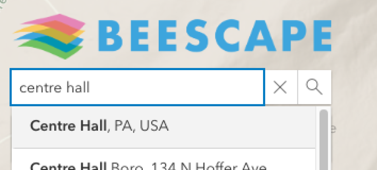
2. Enter a location.
On the left side of the screen, find the search bar, located under the Beescape logo. Type in “Centre Hall, PA, USA”. You may type the whole name or click the autofill option. Your map view will now focus on Centre Hall, PA.
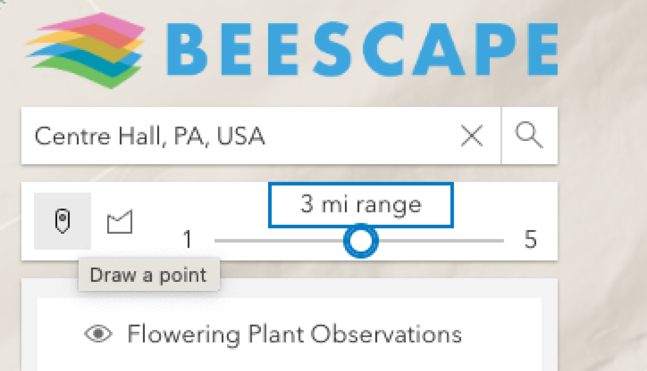
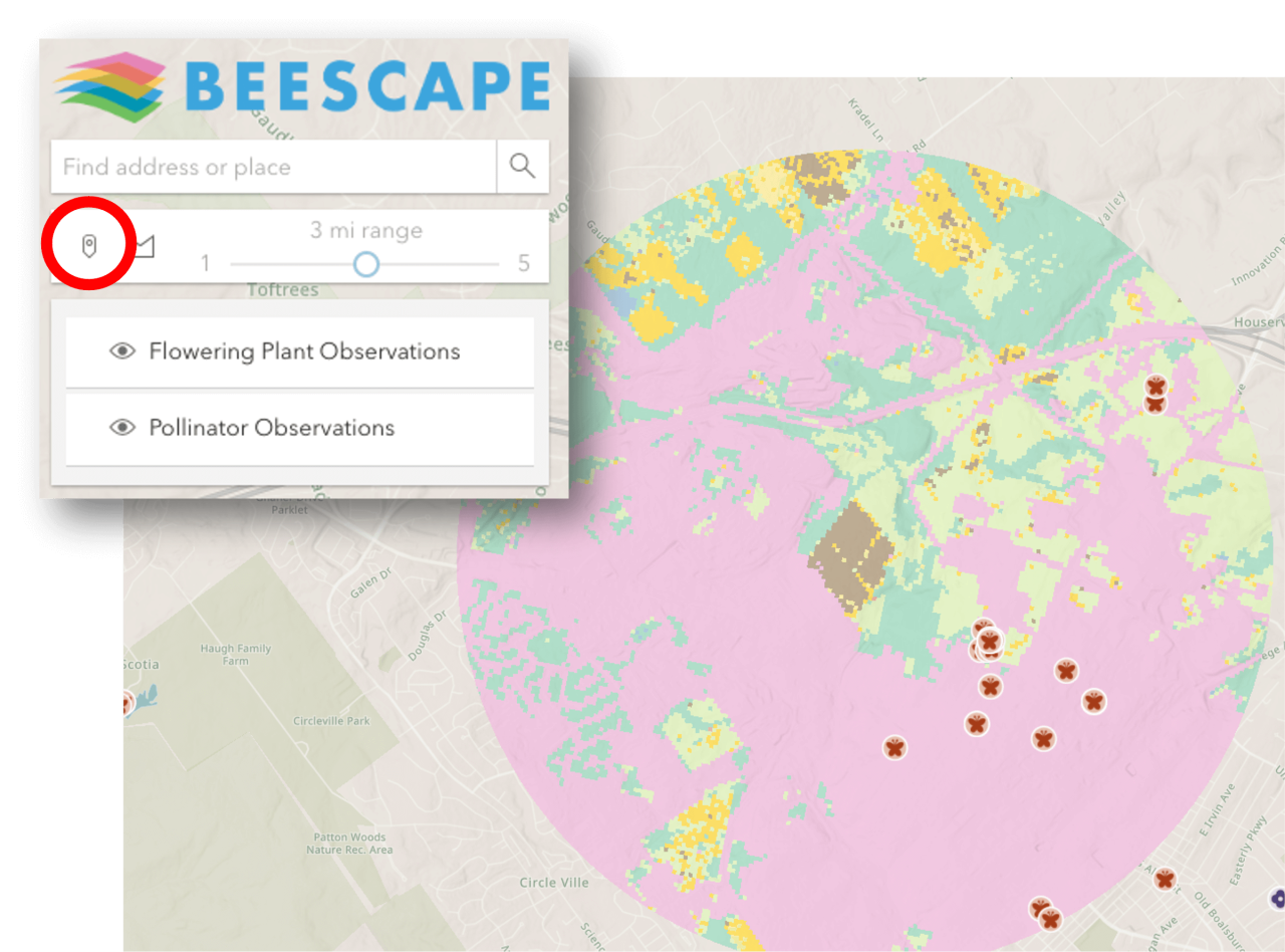
3. Select the Point tool.
Locate the Point tool below the search box, on the left side. This tool allows you to "draw a point" on the map.
4. Move your pointer to the middle of Centre Hall and click once.
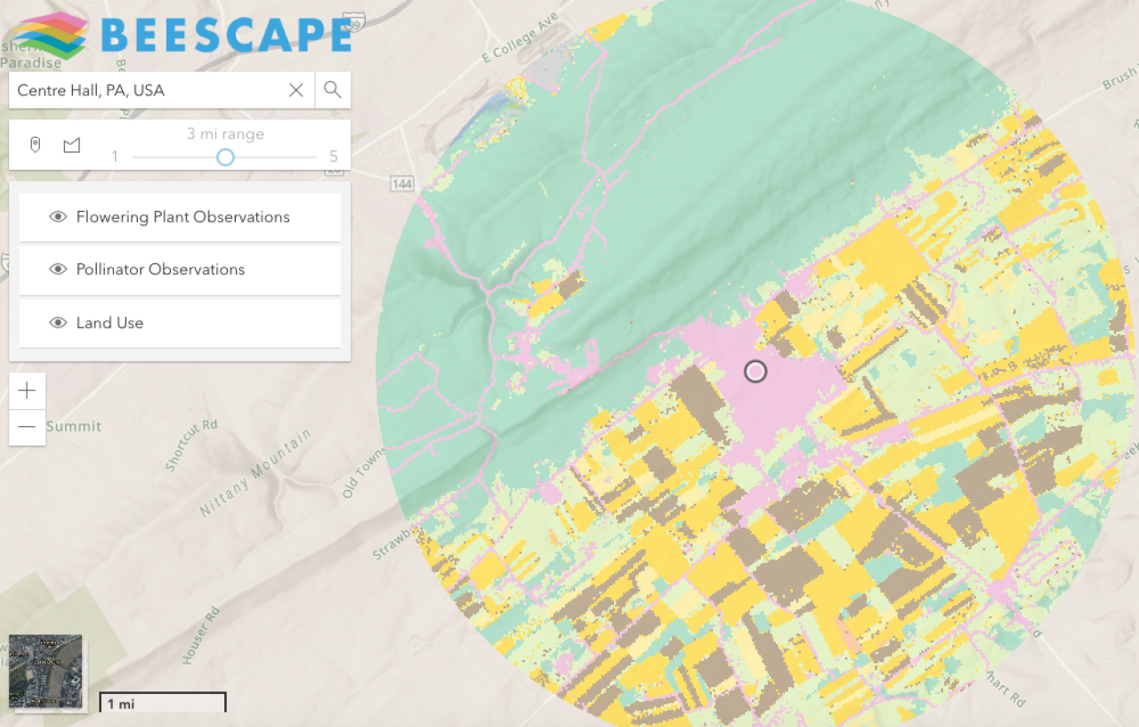
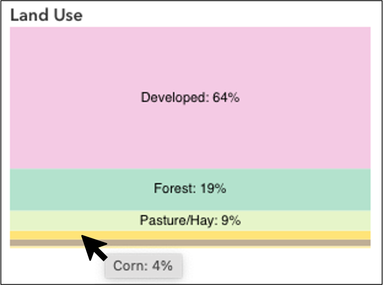
This will create a colorful circle that displays land use within a 3 mile range. Once you have clicked with the Point tool to create a colorful circle, take a closer look.
The circle uses different colors to show land use. For example, green indicates forest, pink means the area is developed, yellow for corn, brown for soybeans, etc.
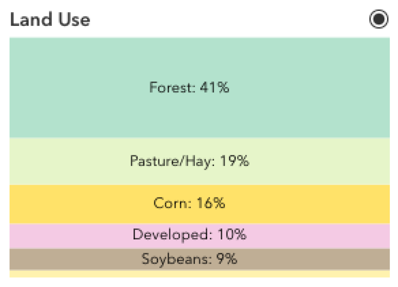
5. View the "Land Use" graph.
The Land Use graph is located in the column on the right side of your desktop screen. Land Use is the second heading. The graph displays the percentage of each major Land Use type for the selected region.
Test your understanding:
What are the top two land uses for this region? Check your answer below.
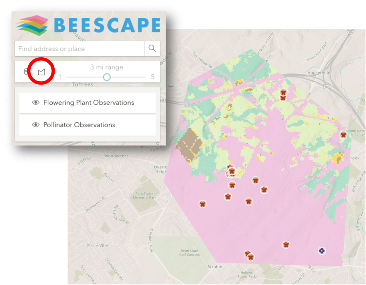
6. Adjust the range to 1 mile.
Select the Point tool, then select the slider and drag it to a 1 mile range. Then, click on the same location in Centre Hall.
Test your understanding:
The land use graph changes to reflect the use of land within only this 1 mile. How do the top land uses in this area compare to the 3 mile circle? Check your answer below.

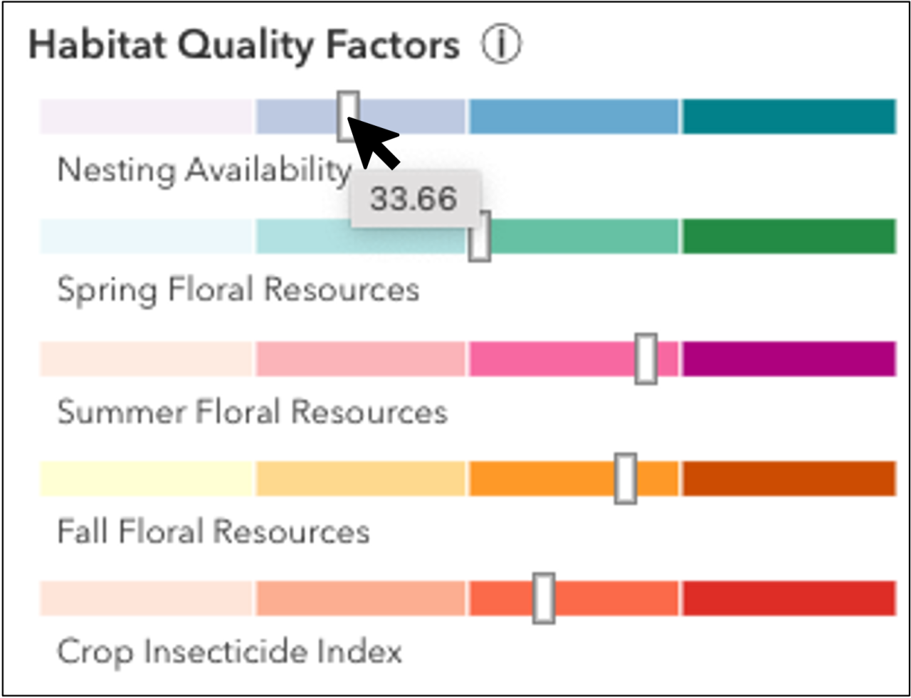
7. View the Habitat Quality Factors chart.
The chart is located at the top of the column on the right side of your desktop screen. The bar chart shows the average score for each factor for the selected region. The small dark mark on each bar indicates how the select region scores for that factor.
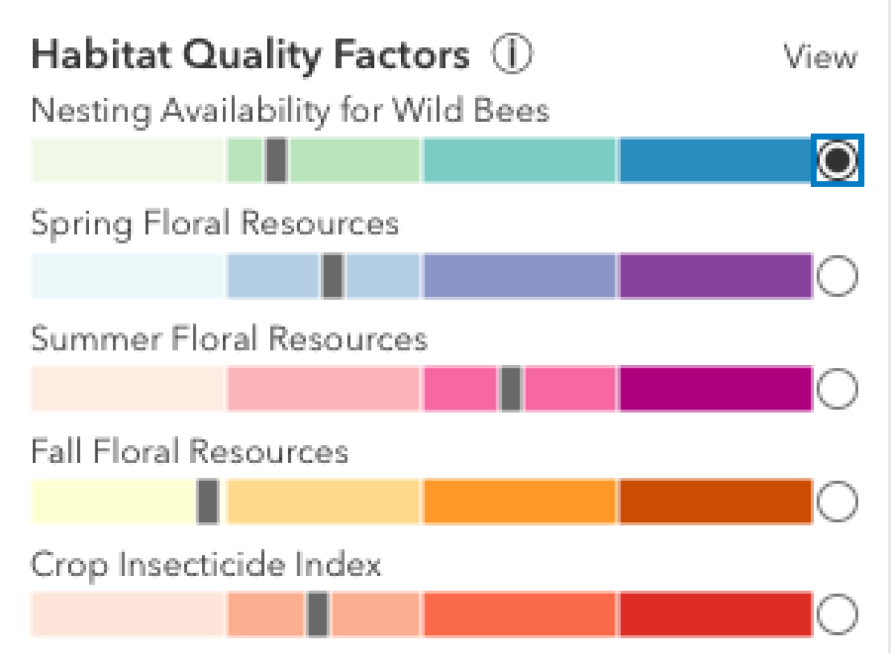
When a score is low, the mark appears over a lighter shade, to the left. When a score is high, the mark appears over a darker shade, to the right. Change the map display from land use to any of these five factors by clicking a radio button.
Test your understanding:
Looking at the bar chart, which of the five habitat quality factors is lowest for the selected region? View this lowest factor on the map by clicking the appropriate radio button. Check your work below.
8. Pan to find State College.
You can find locations by panning the map. Using a mouse, pan from Centre Hall to State College by moving southwest, or, left and down. If you can't find it by panning, you can type it into the search box.
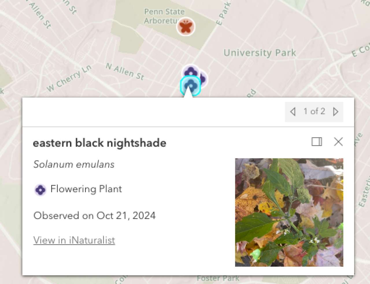
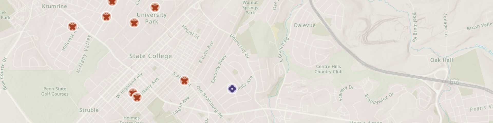
9. View observations from iNaturalist
In State College, there are many pollinator and floral observations from iNaturalist. These are represented by red-orange insect icons and purple flower icons.
Test your understanding:
Find one pollinator observation and one floral observation in State College.
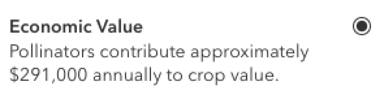
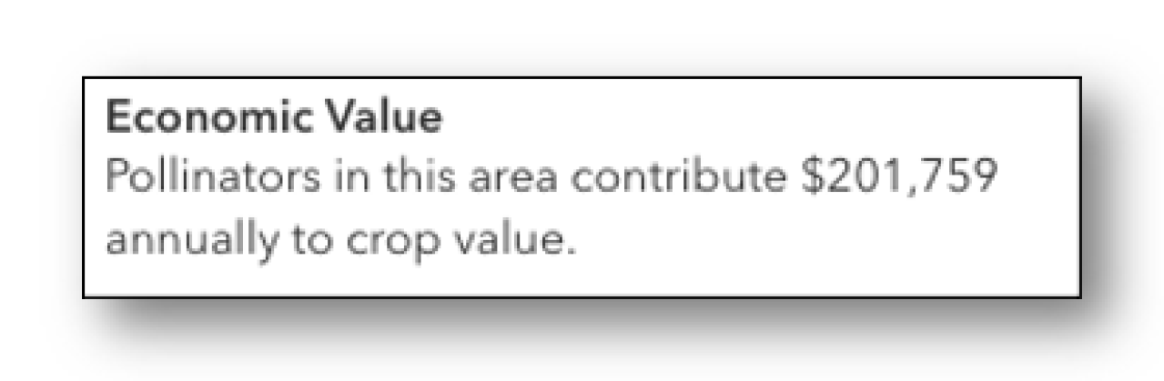
10. View Economic Value
Use the Point tool and slider to create a 5 mile range centered in State College. Look at the third heading in the sidebar, titled "Economic Value." This number is the estimated economic crop value that pollinators provide to the selected region. You can also click the radio button next to the heading to visualize economic value on the map.
Test your understanding:
What is the economic value for this 5 mile region in State College? Check your answer below.
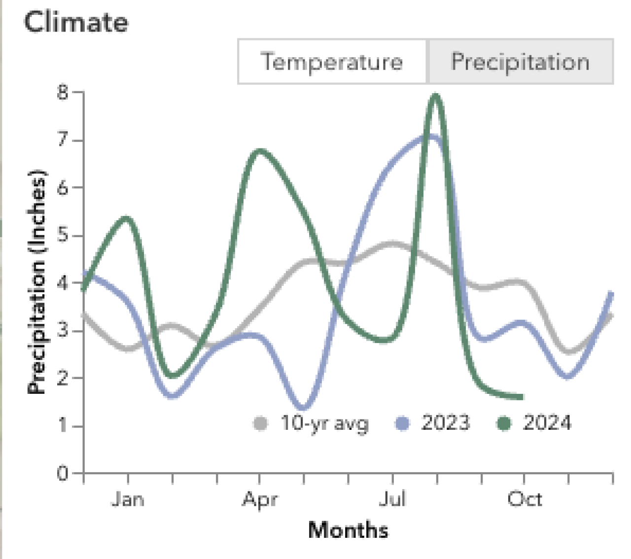
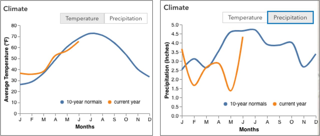
11. View Climate Data
Now, look at the fourth heading, Climate. Initially, the tool shows the average, past year (2023), and current year (2024) temperature for the selected region. By clicking the second button, you can also view precipitation.
Test your understanding:
In 2023, which months experience a spike in precipitation compared to the 10 year average? Check your answer below.
Congratulations! You've completed an initial walkthrough of Beescape and you're ready to explore your own geographic areas of interest.
About Beescape
Beescape is a decision support tool centered around pollinator health. This tool uses GIS (Geographic Information Systems) to help predict the resources and threats that foraging bees encounter as they forage in a landscape. This tool is intended to help people learn how to improve their locations to support bees, or help beekeepers select better sites for their apiaries.